
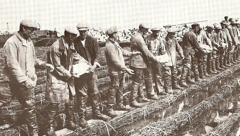
Following the closure of the Zuiderzee, work began on the construction of the Noordoostpolder in 1937. Three years later, the final gap in the 54-kilometre-long dyke was closed. On 9 September 1942, the Noordoostpolder was officially drained. On the dyke near Espel and on the dyke near Nagele, ‘closing gap’ monuments commemorate the historic events surrounding the joining of sections of the dyke. There is even a display panel dedicated to one such gap, so that even today you can see and read about the significance of this impressive feat achieved during the war.
Most of the Noordoostpolder is below sea level, ranging from 1 metre below NAP to almost 5 metres below NAP. To maintain the water level, canals, ditches, weirs and pumping stations have been constructed: the water management system in the Noordoostpolder. This water management system is part of the polder history of the Netherlands. A history of reclamation, development and water management.
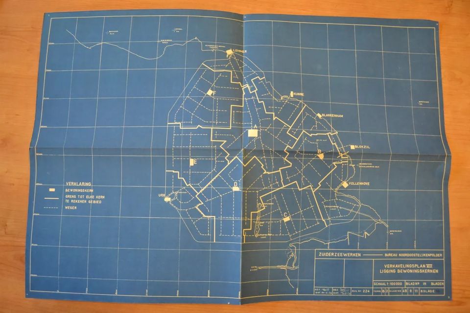
The Noordoostpolder is laid out according to the 1936 Land Use Plan: with one central town (Emmeloord), surrounded by ten smaller villages within cycling distance from Emmeloord (as most people did not yet have a car) and with several canals and waterways.


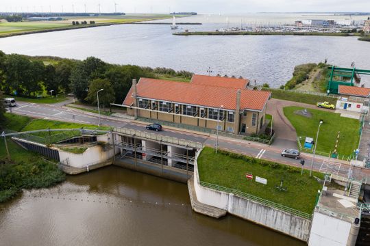
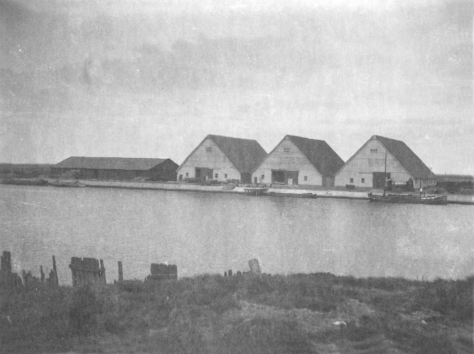
Pumping station Buma was commissioned on 7 January 1941. Until the polder was drained in September 1942, this pumping station was responsible for some 1,000 million m3 of the 1,500 million m3 of water pumped out of the polder.

Smeenge pumping station was commissioned on 22 April 1941. Of the total of ± 1,500 million m3 of water pumped out until the polder was drained in September 1942, Smeenge pumping station is responsible for about 375 million m3.
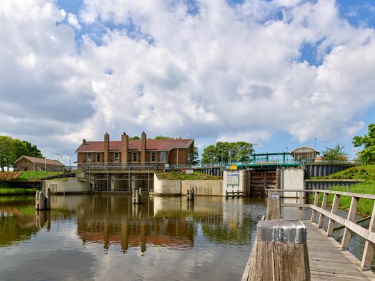
Vissering pumping station was built in 1941 as one of the three main pumping stations of the Noordoostpolderder. Recently, the middle one of the three pumping stations was rebuilt in stone.


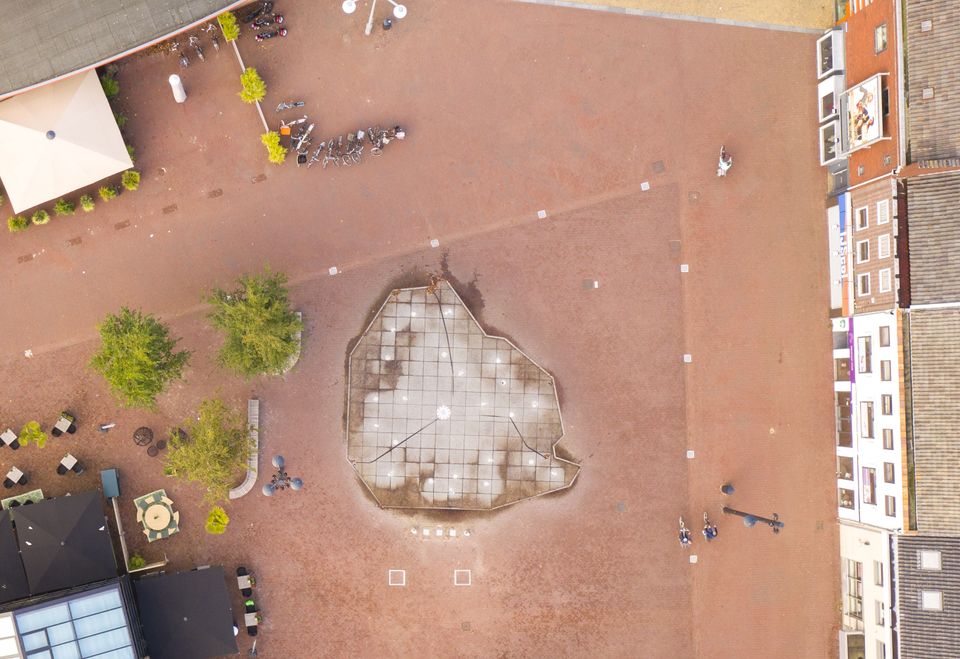
Today, there is a fountain in the shape of the Noordoostpolder municipality in the centre of Emmeloord. In warm weather, it is a desirable playground for children, and for others to watch them, but if you were to view the fountain from above, you would recognise the three main canals to and pumping stations in Lemmer, Urk and Kraggenburg. A nice tribute to the history of the Noordoostpolder.
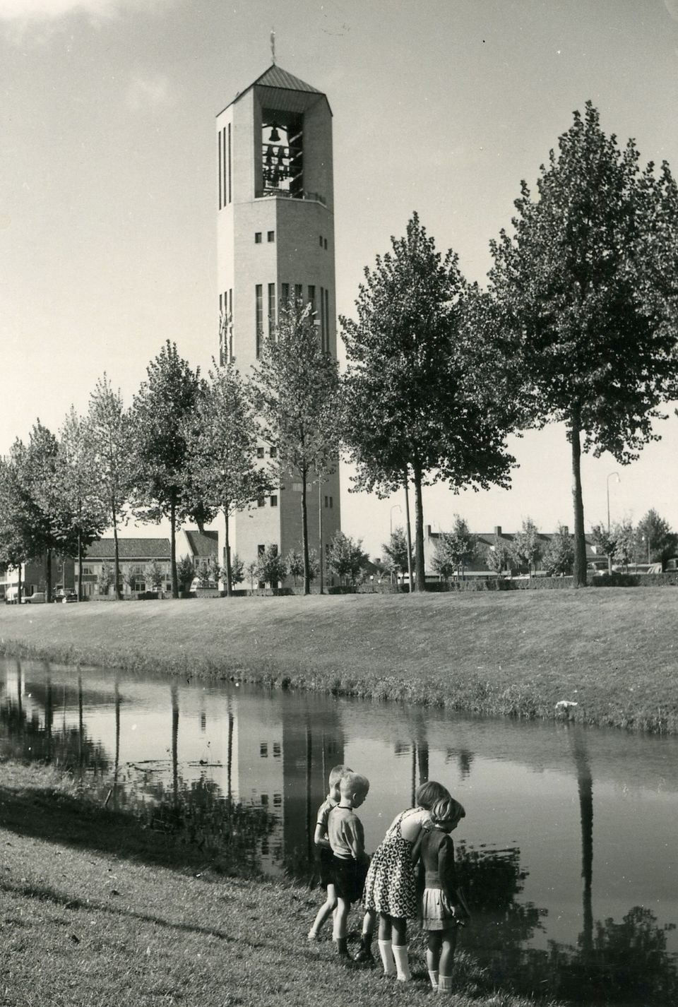
In 1950, a competition was held for the design of the Polder Tower. Amsterdam architect H. van Gent won in 1951 with his design 'Utilis'. This formed the basis for the final design of 1954, which was executed by H. Fokkens. The Polder Tower in Emmeloord was built between 1957 and 1959 as a symbol of victory over water and the unity of the polder inhabitants. The 65.3-metre-high tower was a water tower in addition to being a lookout tower and carillon tower. It stands right in the heart of the Noordoostpolder and has traditionally been a beacon in the new land, which can be seen and heard from far and wide.
At the top is a viewing platform with breathtaking views over the polder. There you can also see the carillon with 48 bells. One of these functions as a swinging bell. At the very top of the Polder Tower is a gilded copper weather vane in the shape of a bowser. This is a reminder of times long gone, when ships of this type still sailed the Zuiderzee.
More about the Polder Tower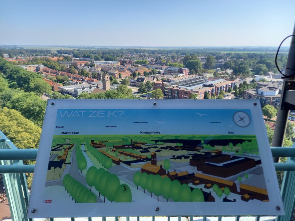
The national monument Waterloopbos is not only a beautiful forest to wander around in, it also has a special history. For years, the Waterloopkundig Laboratorium conducted research there into how water works. In the forest, you will therefore find ruins of scale models of 35 large waterworks from all over the world.
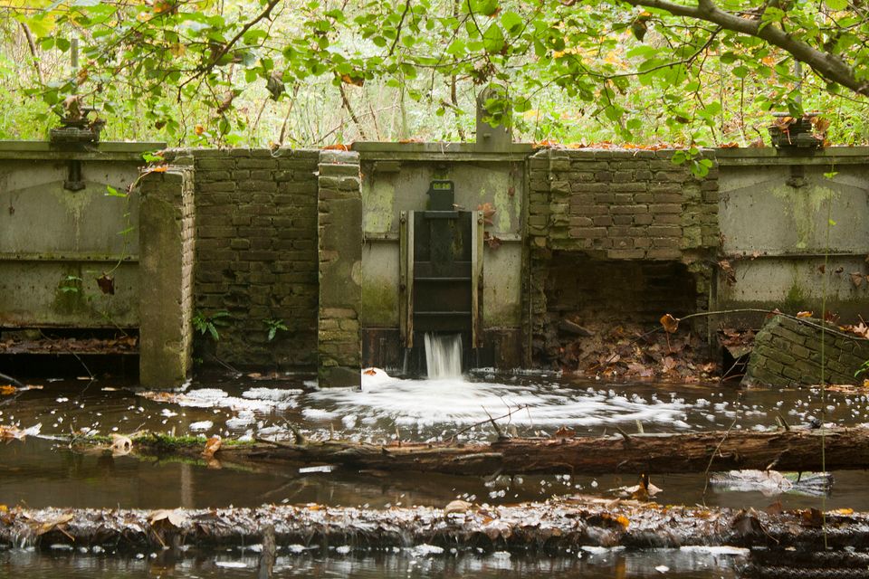
The Delta Works, for instance, were designed there, as well as the ports of Rotterdam, Lagos, IJmuiden, Istanbul and Bangkok. With water, dams, weirs and wave machines, reality could be replicated in the forest. Since the departure of the Hydraulic Laboratory, nature has slowly taken possession of the hydraulic models again. This has created a unique interaction between technology and greenery.
More about the Waterloopbos
In the Waterloopbos stands the gigantic artwork Deltawerk// by RAAAF and Atelier de Lyon, paying homage to the Delta flume, which was built in the forest in the late 1970s. In this almost 200-metre-long concrete colossus, metres-high waves could be created, which were used to test the Storm Surge Barrier in Zeeland, among other things.
More about Deltawerk//
In the Zwarte Meer too – the body of water that separates the Noordoostpolder in the south-east of Overijssel – there is a piece of landscape art that references our water heritage. It is called PIER+HORIZON and consists of a long, straight jetty extending out into the water from the shore, with 20-metre-long reed mats on either side, attached at one end to a post so that they indicate the direction of the current. In the days of the Zuiderzee, a breakwater stood on the site of this jetty, connecting the Oud Kraggenburg lighthouse keeper’s house with the mainland near Genemuiden.
More about PIER+HORIZON
